Pillar: Hazards and constraints
How do you know if a plot has erosion or desertification risk?
On this page
The official source is Spain's national soil erosion inventory, the INES, run by the environment ministry (MITECO). For each province, at 1:50,000 scale, it estimates how many tonnes of soil each hectare loses a year and sorts the result into seven levels, from 0–5 to over 200. The 2007 report for Málaga gives a provincial average of 52.37 tonnes per hectare a year. For a specific plot, check that level against what you see on the ground.
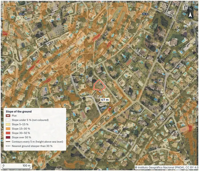

If the plot is on a hillside, dry-farmed or in south-east Spain, start with the national erosion inventory's report for its province, then check the soil itself when you visit.
What the national soil erosion inventory measures
The "Inventario Nacional de Erosión de Suelos" (INES) is a uniform erosion mapping system for all of Spain. It works at 1:50,000 scale, uses the province as its unit and plans a 10-year cycle.
The inventory separates five forms of erosion:
| Module | How it is produced | What it delivers |
|---|---|---|
| 1. Sheet and rill erosion | RUSLE soil-loss model | Map of erosion levels in tonnes per hectare a year, with tables |
| 2. Gullies and ravines | Interpretation of aerial imagery | Map of areas with active gullies and ravines, with loss estimates |
| 3. Mass movement | Qualitative classification | Map of potential and type |
| 4. Stream-bed erosion | Classification by drainage unit | Map of stream-bed erosion risk |
| 5. Wind erosion | Qualitative classification | Map of wind erosion risk |
Modules 1 and 2 estimate soil loss with the RUSLE model; modules 3 to 5 classify areas or risks qualitatively. Source: MITECO, INES general features. Accessed 14 November 2026.
The fieldwork used, on average, one sample plot for every 2,500 hectares: the result is a model estimate, not a measurement taken on your land.
How to read the seven levels
Module 1 groups losses into levels: 0–5, 5–10, 10–25, 25–50, 50–100, 100–200 and over 200 tonnes per hectare a year. The Málaga report gives a sense of scale: with a topsoil density of 1.2 tonnes per cubic metre, losing 12 tonnes per hectare a year means losing 1 mm of soil a year.
That is why the INES also grades erosion by how fragile the soil is, from "nula" (none) to "muy grave" (very severe); very severe means the organic topsoil would last less than 10 years. Where many field plots hit bedrock within 25 cm, the grade goes up one or two steps.
Málaga in figures
The INES report for Málaga, the province of the sample plot in our report, was published in 2007.
The provincial average is 52.37 tonnes per hectare a year. The report names the Axarquía district as the worst affected, with nine municipalities above 100. It grades 73.16% of the province as very severe, largely matching rain-fed olive groves and fruit trees on slopes.
A provincial average does not describe your plot. The 1:50,000 map gives an estimated level; rills, gullies and thin soil show only on the land.
Where to download the data for your province
MITECO's INES pages offer the 2022 national summary and downloads by region, with maps and provincial reports; the Andalusia page covers all eight provinces.
For your plot, give a surveyor the property's cadastral reference and ask them to lay its outline over the INES "Erosión Laminar" (sheet erosion) layer, published as a WMS map service in MITECO's biodiversity data directory. Ask in writing which level or levels it falls into and the year of the report; it is still a 1:50,000 estimate.
Erosion and desertification are not the same
Desertification, in the UN Convention definition quoted by MITECO, is land degradation in arid, semi-arid and dry sub-humid areas, driven by climate and human activity. These are areas with an aridity index (rainfall divided by potential evapotranspiration) of 0.05 to 0.65: almost three quarters of Spain.
MITECO separates aridity, a natural feature, from desertification, which needs a human factor.
If you will claim EU farm subsidies
Royal Decree 1049/2022 sets the EU Common Agricultural Policy's (CAP, "PAC" in Spanish) "condicionalidad reforzada" (enhanced conditionality) rules for people receiving CAP direct payments, certain annual rural development payments for land and animals, or POSEI payments in the Canary Islands (article 1). Recipients must keep the good agricultural and environmental condition standards (the BCAM rules in annex II) across their whole holding, plus any set by their region (article 3).
BCAM 5. On arable or tree crops you may not plough in the direction of the steepest slope where the field's average slope is 10% or more, unless terraces or banks offset it. Where there are terraces, no work may affect their banks. Plots of up to 1 hectare are exempt, as are irregular or elongated tree-crop plots whose narrowest width across the slope is under 100 metres at any point. The region can allow downhill ploughing where cross-slope work risks tipping a tractor. For tree crops planted before 1 January 2023 whose planting pattern, irrigation or training system rules out cross-slope work, it can grant an individual authorisation for vertical tillage (a plough that does not turn the soil over) downhill, only if there is no alternative, no erosion risk and the case is justified (article 17 bis). Vineyards have their own exceptions.
BCAM 6. On tree crops with a slope of 10% or more and no terraces, a ground cover at least 1 metre wide, sown, self-seeded or inert (non-living material), must be kept from October to March in the alleys running across the steepest slope; alleys running with the slope are allowed only where the plot layout or irrigation rules out the other direction. The region can adjust the period, to no less than four months in a row within October to March, and can authorise removing the cover when it competes with the crop or prevents harvesting. No tree may be grubbed up either, except in areas where this is provided for and with authorised replanting. The full rules, including those for vineyards, are in annex II of Royal Decree 1049/2022.
Breaches are penalised by cutting or withholding that aid. There is no penalty where the holding has 10 hectares or less of declared farmland (article 14.1).
Two olive groves on a 14% slope
A buyer who plans to claim CAP aid compares two olive groves with no terraces, both on fields with a 14% average slope. The 3-hectare grove is a regular plot, more than 100 metres wide across the slope at every point, with no regional authorisation: they may not plough downhill and must keep the BCAM 6 cover. It would only be exempt from BCAM 5 if it were irregular or elongated and also narrower than 100 metres across the slope at some point. An individual authorisation under article 17 bis, on the conditions above, would only allow some vertical tillage downhill, without turning the soil; the BCAM 6 cover would still be required. The 0.8-hectare grove is exempt from BCAM 5 because of its size, but BCAM 6 contains no such exemption, so the cover is still required.
The slope of the SIGPAC field
The slope that counts for BCAM 5 is the average slope of the field as recorded in SIGPAC, the farm-plot register used for CAP subsidies. It is calculated from the national mapping agency's (IGN) elevation model using the neighbouring-cell method (Royal Decree 1049/2022, annex II). It is not the slope in a survey or a report. You can look it up in the SIGPAC viewer.
If the holder of the field, or someone who can show they farm it, disagrees with a field entry such as the slope, they send a reasoned, documented request to the region where it lies. If the error is in the map or data of the cadastral parcel itself, the request goes to the authority that runs the property Cadastre in that province (Royal Decree 1047/2022, article 21.1).
Unless the region sets other deadlines, a change can be requested at any time, but to count towards a subsidy claim it must be in before that claim's deadline. For the CAP single application ("solicitud única") that cut-off is never before the end of its amendment period, and farmers who must adjust it after the checks can request the change within the periods of article 112 of Royal Decree 1048/2022 (Royal Decree 1047/2022, article 21.3).
What to look for on a visit
Cracks, shifted walls or slipping ground are about stability: see the guide on landslides and slopes. For erosion, each sign has a place where you can check it:
If you are viewing from abroad, ask the seller or agent for photos after heavy rain and how the land has been ploughed.
What to do, in order
- Read the INES report for your province and find the municipality in its table of losses by municipality. Where: MITECO website, downloads by region (direct, with no registration); the ministry's nature data bank ("Banco de Datos de la Naturaleza") states open access to its data. When: before viewing the plot; note the year of the report.
- If you want the level for the exact boundary, commission a surveyor with the cadastral reference (see the download section). No rule sets the time or the fee: the surveyor quotes both for that plot, so get the quote in writing before you instruct them.
- Visit after recent rain. Look for rills, gullies, collapsed terraces and very thin soil. Who: you, or the surveyor as part of the job. When: before paying the "arras" (the deposit under a preliminary contract).
- If you will claim CAP aid, check the SIGPAC field. Where: SIGPAC viewer. Look at the average slope and whether there are terraces. When: before the arras. For corrections, see the SIGPAC section above.
- Ask the regional agriculture department about adjusted cover periods and ploughing authorisations. Who: you, or a Spanish-speaking adviser. When: before your first subsidy claim.
Limits of this guide. The Málaga report dates from 2007. This guide covers the national CAP conditionality rules; regional soil conservation and forestry rules have not been reviewed here.
- You know the municipality's average erosion level and the year of the INES report.
- You have seen the plot and photographed any rills, gullies or damaged terraces.
- If you will claim CAP aid: you know the SIGPAC field's average slope and whether a BCAM 5 exemption covers it.
- If the plot borders woodland or has burnt, you have read the guide on forest land and wildfires.
Going to see the plot? Order the report with its cadastral reference and read the slope and geology pages before you go.
Common questions
What does an erosion rate of 50 tonnes per hectare a year mean?
That, according to the INES model, each hectare loses about 50 tonnes of soil a year. Using the Málaga report's rule of thumb, that is about 4 mm of soil a year.
Do I have to follow BCAM 5 if I do not claim CAP aid?
Not under Royal Decree 1049/2022, which applies to people receiving the aid in its article 1. If you later claim that aid, it binds you across your whole holding, with the exemptions in the rule.
Can I repair the terraces on the plot?
Royal Decree 1049/2022 requires aid recipients not to alter retaining terraces without express permission from the competent authority (BCAM 8), though it exempts building small check structures to correct gullies, rills and terraces. For any building permit, ask the town hall.
Is my municipality at risk of desertification?
MITECO treats arid, semi-arid and dry sub-humid areas, almost three quarters of Spain, as susceptible. That describes the climate, not the state of your plot.
Keep reading
Check this on your own plot
Pin the plot on the map and confirm the cadastral reference: the report gathers the public data and official maps for it, each with its source and date. It does not replace the land registry extract, the notary or a tax adviser. €29 VAT included.