Pillar: Hazards and constraints
How do you check a Spanish plot for landslide risk?
On this page
Check IGME mapping and commission a competent professional to assess the ground and proposed works. The national 1:1,000,000 map provides context rather than parcel-level stability certification. Modelled slope is not a landslide probability; a ground study must address the building and its surroundings.
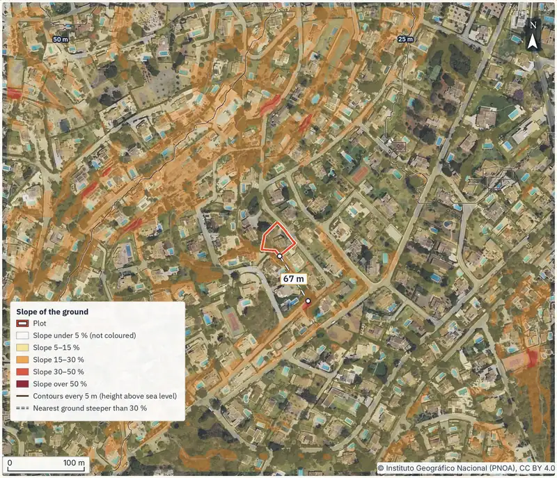
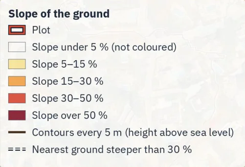

For a hillside purchase, tell the professional where you hope to place the house, driveway and excavations. The area needing assessment can extend beyond the building footprint. If you do not yet have a design, ask what preliminary information is needed to judge whether the purchase is feasible.
Separate the questions a map cannot combine
How steep is the ground? Which geological processes may affect it? How would it behave with your proposed works? These are different questions, and a slope percentage does not answer all of them.
The Instituto Geológico y Minero de España, or IGME, national ground-movement map distinguishes horizontal movements, including landslides and rockfalls, from vertical movement, coastal processes and movements associated with mining. Ask the professional to name the process being investigated rather than treating every difficult hillside as a landslide site.
A useful purchase brief asks whether instability could affect the building or access, including from outside the plot. The answer should state what can be concluded and what remains uninvestigated. A remark that the exposed surface “looks like solid rock” does not address the full question.
Understand the national map’s scale and date
The official IGME page identifies the national map as a 1987 publication at 1:1,000,000. It delineates areas with different movement types and represents the most intense and frequent processes. Keep that date and intended scale with any extract you use.
At this scale, one centimetre on the map represents ten kilometres on the ground. Zooming in does not create finer source information. A mapped boundary near your property cannot by itself locate the edge of a process within a garden or building footprint.
Use the official product page and map services. Record the layer, product date and scale, together with your access date. Ask the professional whether a more detailed inventory or map is available and what field verification is needed for this location.
Turn the viewing into a record of questions
Take located photographs of the hillside, retaining structures and places with repairs or changes you want explained. Ask the seller for retaining-wall designs, drainage records and previous ground investigations. A recently repaired wall is a reason to request evidence, rather than to invent a diagnosis. Rills, gullies or soil washed downhill by rain raise a different question, covered in the guide to soil erosion on a plot.
Also record what you could not see. A short dry-weather viewing cannot establish every water condition or the site’s history. The building code requires collecting information on site peculiarities, instability, landslides and groundwater, among other matters.
Do not enter an unsafe area to test your own theory. Let a competent professional decide the inspection method. Photographs help direct an enquiry; an isolated crack in a photograph does not establish that the whole holding is moving.
| Evidence | Question it helps frame | Limitation |
|---|---|---|
| Contour survey | Where are level changes, cuttings and approaches? | It does not describe the subsurface alone |
| Located photographs | Which areas need inspection? | They do not establish cause or age |
| Earlier ground study | What building and ground were investigated? | Your design may differ |
| Retaining-wall designs and records | What was designed and built? | Compare with the current condition |
| Ground-movement mapping | Which processes does the product record? | Coverage and scale constrain interpretation |
Evidence for the professional brief. The CTE ground study relates the ground to the building and its surroundings; an isolated observation is not a diagnosis. Source: CTE DB-SE-C, section 3. Accessed 13 November 2026.
Make the investigation match your proposal
Section 3.1 of DB-SE-C, the foundations document within Spain’s Código Técnico de la Edificación, relates the geotechnical study to the proposed building and its surroundings. It places the work early in the design, before the structure is fully sized. It should not simply be commissioned at the end to support an already fixed design.
For T-3 ground, section 3.2.1.15 requires additional investigation points in problematic areas until they are adequately defined. This guide does not prescribe a standard drilling package. The competent professional must determine the scope from the ground, building and the document’s remaining requirements.
Explain whether your plan includes a pool, excavations, fill or retaining walls. Ask whether the quoted work addresses overall stability and the relevant surrounding area. A study for a smaller house elsewhere on the land may be useful background without answering the questions for your proposal.
Read the 15-degree figure for its actual purpose
DB-SE-C table 3.2 includes ground in landslide-susceptible areas and ground steeper than 15° among unfavourable T-3 terrain. The figure belongs to the classification used in planning ground investigation. It does not declare every steeper plot unbuildable or every gentler plot problem-free.
Degrees and percentages also differ. A 15% slope is not a 15° angle. When comparing a report with a planning provision, ask for the unit, measurement method and area being assessed. The planning certificate enquiry should address the actual local plan rather than an assumed rule taken from a map legend.
An overseas buyer should keep the Spanish planning wording beside its explanation. Terms translated loosely as “gradient limit” may concern a specified calculation that is different from local cell slopes in a terrain model. Ask the designer to identify exactly which measurement is being used.
Torrox: an average is not the whole hillside
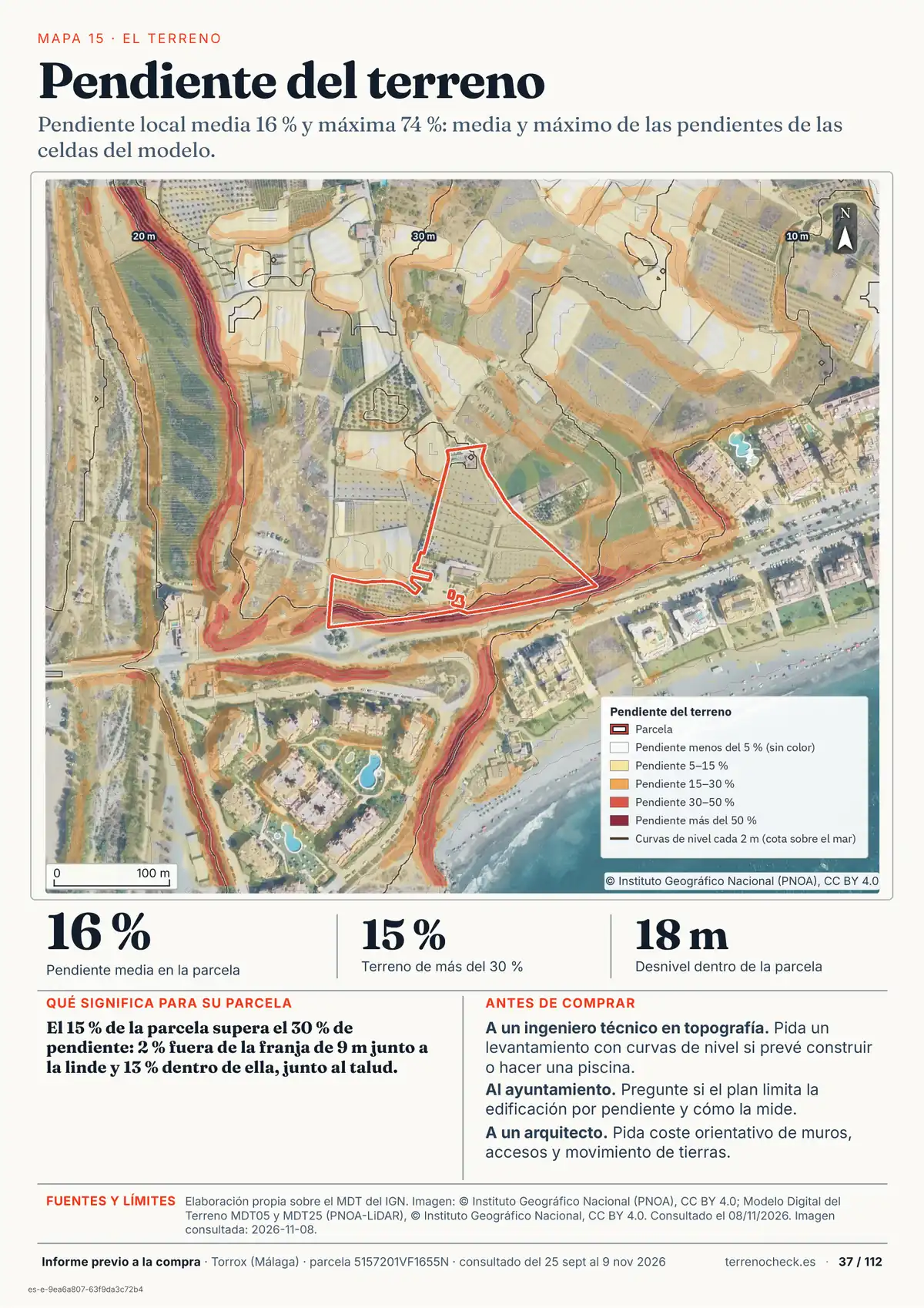
Page 37 of the sample report concerns plot 5157201VF1655N in Torrox, Málaga. It shows a local mean slope of 16% and a local maximum of 74%. These are the mean and maximum of cell slopes in the model, derived by the report from IGN terrain data consulted for the sample on 8 November 2026.
The maximum does not describe the whole plot. The mean does not identify a suitable foundation location either. A proposed building position needs detailed surveying and ground investigation; the report’s map helps identify questions to take to that assessment.
Set the budget and decision date around the evidence
Ask for a written quote in euros identifying the visit, field investigation, laboratory work, analysis and report. The required scope determines what must be priced. Compare quotes for the same proposed investigation and ask each provider to identify excluded work.
Adding up a quote line by line
Assumed figures to practise the sum, not market prices or an average: site visit and investigation plan, €250; two investigation points at €700 each, €1,400; laboratory tests, €450; analysis and report, €600. Total: €2,700 before VAT. Excluded: clearing access for drilling machinery, any extra points the engineer requires in problem areas, and a slope stability analysis if the quote does not name one. A site visit alone is not that study.
Agree a delivery date and identify dependencies, including machinery access and seller records. DB-SE-C does not set a single commercial delivery period for this private appointment. If the result is needed to decide whether to buy, make that requirement clear to your adviser before agreeing contractual dates.
A recommendation for further investigation is not a positive feasibility conclusion. Request a list of unresolved questions and have your adviser explain their effect on the purchase conditions. The guide to arras deposits helps distinguish the agreement you are signing from the technical answer still awaited.
Buying remotely with an existing seller’s report
Ask for the full report with its plans and annexes, rather than an English summary selected for the sale. Have your professional check its location, date, proposed building and investigative scope against your intentions. Changes should be identified before relying on its conclusions.
If additional access to neighbouring land is needed to investigate a concern, establish how that will be arranged. Do not assume the cadastral boundary defines the physical extent of every relevant process. Your appointment should state any access or information limitations so they remain visible when deciding whether to proceed.
The old study covers a different building position
A seller supplies a ground report for a house planned near the road. The buyer wants to build farther uphill with a new cutting. The appointed professional treats the earlier report as background and defines what additional assessment is required for the changed position before the buyer relies on it.
A sequence for a hillside purchase
- Identify the site and proposal. Obtain the reference, boundaries and intended works from seller and designer. Agree document delivery; there is no single national period for assembling this private brief.
- Check suitable official mapping. Use IGME and relevant official local sources online where available. Save scale and version; completing the record depends on coverage rather than a guaranteed instant result.
- Commission the ground assessment. Agree scope, fieldwork and report date with a competent professional. For the building design, the study belongs at the initial stage, before the structure is fully sized.
- Confirm planning conditions. Ask the town hall about the proposed position and any slope measurement rule. Use the municipal service’s stated processing period rather than a nationwide assumption.
- Review conclusions before commitment. Have the professional and adviser identify limitations, further work and contractual consequences. Agree the review date around the evidence still needed.
Keep separate risks visible A slope assessment does not replace flood or seismic checks. Where relevant, review flood mapping and seismic requirements separately. This guide also gives no insurance coverage decision: obtain the policy wording and an answer for the particular circumstances.
- Mapping identified with date, scale and limitations.
- Proposed building and access marked on the reviewed plan.
- Retaining works, drainage and repair records requested.
- Professional brief expressly addressing stability.
- Conclusions, unresolved work and purchase conditions reviewed.
You can order the plot report to locate changes in relief and prepare the checks your professional needs before the purchase.
Common questions
Does a steep gradient establish landslide risk?
It does not establish the process or its probability alone. Assess the site and proposed works.
Can the national IGME map fix a boundary inside my plot?
The 1:1,000,000 product provides context. Enlarging it does not create parcel-level precision or replace a site investigation.
Does the building code prohibit construction above 15°?
The cited figure belongs to geotechnical category T-3. A technical assessment and planning check are needed; that table does not create a general building ban.
Can I rely on the seller’s earlier ground study?
Have its scope, location, design and evidence reviewed. Do not assume it addresses your building or every stability issue.
Keep reading
Check this on your own plot
Pin the plot on the map and confirm the cadastral reference: the report gathers the public data and official maps for it, each with its source and date. It does not replace the land registry extract, the notary or a tax adviser. €29 VAT included.