Pillar: Hazards and constraints
What restrictions apply to building or buying land next to the Mar Menor?
On this page
In Murcia, the town plan applies alongside the Mar Menor, coastal and water rules. Ley 3/2020 restricts agriculture within 1,500 metres of the shore. New homes are generally prohibited in the coastal protection easement, subject to exceptional and transitional regimes. On flood-prone land, raising a house does not replace water-authority approval.

Which rule decides what
| Layer | What it restricts | Where to check |
|---|---|---|
| Law 3/2020, 1,500 m strip | Fertilising, greenhouses and land set aside on farms (art. 29) | Distance to the inner limit of the shore; the regional department in charge of nitrates |
| Law 3/2020, Zones 1 and 2 | Turning dry land into irrigated land without an earlier water right (art. 28.1); measures for new developments (art. 17) | Annex I of the law |
| Coastal Law | Homes in the protection easement; a 6 m public right of way (arts. 25 and 27) | The State's coastal boundary (deslinde) |
| RDPH, flood zone | Where and how high a new house sits; risk declaration and Registry entry (art. 14 bis) | The SNCZI flood viewer (MITECO, the environment ministry) |
| Town plan | Land class and permitted uses | Town hall, planning information in writing |
Rules in force on 12.11.2026 according to the BOE consolidated texts: Law 3/2020, update of 6.9.2023; Coastal Law, of 11.12.2015; RDPH, of 3.6.2026. Sources: Law 3/2020 on the recovery and protection of the Mar Menor (BOE, consolidated text); Law 22/1988, Coastal Law (BOE, consolidated text); Public Water Domain Regulation (BOE, consolidated text). Accessed 12 November 2026.
The 1,500-metre farming strip
Article 29 restricts farming within 1,500 metres of the inner limit of the Mar Menor shore. The exception for organic, sustainable and precision crops beyond 500 metres requires all of article 29.2–4. Chemical fertilisers, uncomposted manure and green manure remain prohibited even on those farms; the 170 kg N/ha/year ceiling does not permit prohibited products (article 29.4.a–b).
Any farm wholly or partly inside the strip sets aside 20 % of its area for vegetation belts, green filters, ponds and wetlands, bioreactors or woodland (arts. 29.3 and 37.2). New greenhouses, and extensions of existing ones, are not allowed (art. 29.4.d).
To farm a plot in the strip, the holder files a prior notice (comunicación previa) with the regional department responsible for nitrate control, together with a report signed by a qualified technician, and can then go ahead without waiting for an answer (art. 29.5). If you are buying a smallholding to grow citrus or vegetables, ask the seller for that notice and the report.
Dry land and irrigation in Zones 1 and 2
In Zones 1 and 2 of Annex I, dry land may not be turned into irrigated land unless a water-use right was obtained before the law was published (art. 28.1). A plot advertised as ‘suitable for irrigation’ is not irrigable just because it sits in the Campo de Cartagena: ask for the water-right title. How to check it is explained in wells and water rights.
The temporary exclusion area
The law set up a temporary exclusion area (Annex II) for new urban developments not approved before it came into force, except extensions of consolidated urban land (art. 16.1). Inside it, public-interest permits were suspended for industry (solar plants excepted), shops and logistics, hotels and tourist lets, restaurants, leisure and any use on flood-prone land, with exceptions for projects of regional interest, tourism or strategic projects shown not to affect the Mar Menor (art. 16.4).
The text in force sets the duration: until the Land-Use Plan for the Mar Menor catchment is approved ‘and in any case for a maximum period of three years from the entry into force’ of the law, which was 2.8.2020. That cap fell in August 2023.
Decree-law 3/2023 and the pending plan
Decree-law 3/2023 of 3 August rewrote article 16 so that the exclusion would last until the plan was approved, with no cap in years. The Standing Committee of the Regional Assembly repealed it on 1.9.2023 (BORM no. 206, 6.9.2023), and its changes to articles 15 and 16 and Annexes I and II lost effect.
The plan was due within three years (art. 15.1). The regional gazette (BORM) of 20.7.2026 publishes a court challenge over the ‘falta de aprobación’ (failure to approve) of the plan, known as POTMARME. Once approved, it will review whether undeveloped land is still suitable and how flood-prone it is (art. 15.2.b), so an unbuilt sector may see its conditions change.
Check the version of the law on the day you sign. On 12.11.2026 the BOE showed no amendments to Law 3/2020 after September 2023. If a reform is published in the BORM, this guide may be out of date. How article 16 applies to a sector today is for the town hall to say in writing, not an estate agent.
New developments: the article 17 measures
New developments in Zones 1 or 2 outside the exclusion area must include permeable paving, separate stormwater and sewage networks with reuse, nature-based solutions and sustainable drainage (art. 17.1). New marinas are banned on the Mar Menor (art. 62.1).
Flood risk: Los Alcázares and the Campo de Cartagena
The Public Water Domain Regulation (RDPH) depends on how the land stood on 30.12.2016. On rural land, the preferential-flow zone admits no new buildings (art. 9 bis.1.b), subject to the cases and full conditions of article 9 bis.2. Elsewhere in the flood zone, new buildings go outside it ‘where possible’; if not, regional rules apply, and a new home must sit at a level the 500-year flood does not reach (art. 14 bis.1). On land that was already urbanised, new buildings may be allowed, following the same criteria as far as possible (art. 14 bis.2).
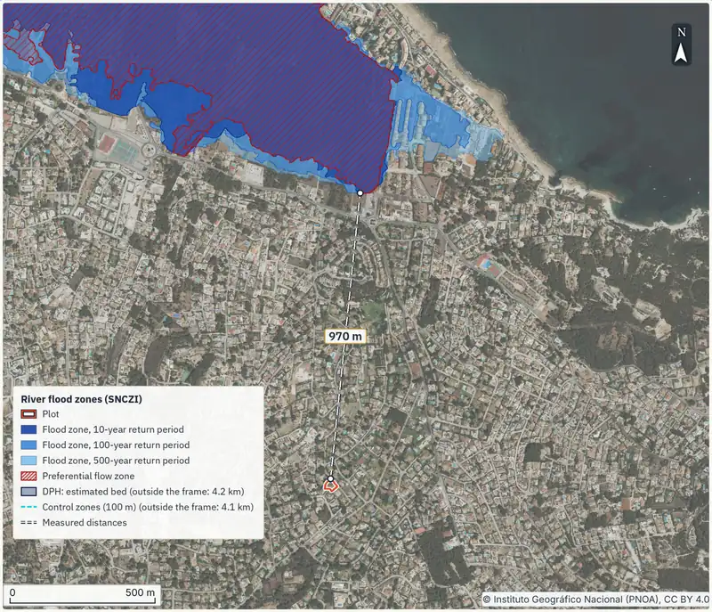
Whoever promotes the works signs a declaration accepting the flood risk. It goes into the authorisation file or, if there was none, is lodged with the water authority at least one month before work starts. Before building, the promoter also needs a Land Registry certificate showing the flood-zone entry (art. 14 bis.3 and 14 bis.4). How to read the viewer: flood zones and the SNCZI; insurance: flood-zone insurance.
Article 14 bis.5 also requires the correct water-law procedure. Within the watercourse policing zone, obtain the basin authority’s permit or use the declaration procedure where article 9.4 allows it. Outside it, the competent authority authorises the activity with a prior hydraulic report, unless a previously reviewed plan already incorporates the authority’s requirements. The risk declaration and Registry certificate do not replace that procedure.
A real reading at Los Alcázares
On 12.11.2026 we queried a farmland point west of Los Alcázares town centre (37.7400 N, 0.8640 W). The regional planning service (IDERM, run by the regional government, CARM) returns ‘Suelo No Urbanizable’ (non-developable land), area ‘SNU-2. Regadíos y Cultivos Forzados.’. MITECO's flood service shows water depth there for 10, 100 and 500 years; the coastal flood layer returns no value.
A point is not a plot. The land class is certified by the town hall under the plan in force, and the flood area may cover only part of the land.
A new house at that point, if the plan allowed one
Suppose the plan allowed a home there, which this guide does not claim. If it were not a preferential-flow zone, the RDPH first asks for a site outside the flood zone. If there is none, the living space must sit above the 500-year flood, which the map puts at 0.261 m over the ground there; your architect sets the exact level. The promoter must also complete the applicable hydraulic procedure under article 14 bis.5, sign the risk declaration and obtain the Registry certificate. A map depth of 0.261 m is not a design elevation.
Coast: boundary, protection strip and La Manga
Law 3/2020 speaks of land ‘próximos al dominio público marítimo-terrestre’ (next to the State-owned coastal zone) of the Mar Menor (art. 29) and measures its farming strip from the inner limit of the shore, as the Coastal Law does. The protection easement runs 100 metres inland and can be widened by another 100 (art. 23); new homes are generally prohibited (article 25.1.a), subject to the exceptional regime in article 25.3. Existing buildings and exceptional new residential authorisations require separate review under transitional provision 3.3; ask Costas to confirm which regime applies. Where the land was urban when the law came into force, the width is 20 metres (transitional provision 3.3).
The first 6 metres stay open for public passage (art. 27.1), and planning respects a zone of influence of at least 500 metres (art. 30.1). The pending regional land-use plan also covers La Manga del Mar Menor (art. 15.2). How to find the deslinde and what works an existing house may carry out: the Coastal Law.
What to do, in order
- Locate the plot in both viewers. MITECO's SNCZI and the regional IDERM service. Online and free; a few minutes.
- Ask the town hall for planning information in writing: land class, permitted uses and whether articles 16 and 17 affect the sector. The national Land Law (TRLSRU) gives you a right to receive it ‘en plazo razonable’ (within a reasonable time, art. 5.d); no set number of days. A lawyer with a power of attorney can file it for you if you are abroad.
- Check the coastal boundary if the land is near the shore. No deadline is set for the enquiry; do it before paying the deposit (arras).
- If you will farm within the 1,500 metres, file the prior notice with a technical report at the regional department in charge of nitrates; you may proceed without waiting for an answer (art. 29.5).
- Establish and complete the hydraulic procedure in article 14 bis.5 with the basin authority before building. In addition, lodge the risk declaration at least one month before work starts when it is not part of a water authority permit, and obtain the Registry certificate before building (RDPH, art. 14 bis.3 and 14 bis.4).
Purchase taxes in the Region of Murcia (transfer tax, ITP, or VAT) are covered in the cost of buying a home.
- Written planning information from the town hall, with land class and uses.
- The plot's distance to the shore and, if it is farmland, the art. 29.5 notice.
- The SNCZI map for 10, 100 and 500 years, and the coastal layer.
- The coastal boundary and the easement width that applies.
- The water-right title, if the land is irrigated.
Before you call the town hall, you can order the report for the plot using its cadastral reference and arrive knowing the flood zones, the coastal boundary and the protected areas around it.
Common questions
Can you build a new house next to the Mar Menor?
It depends on the town plan. On top of that, new homes are generally prohibited, subject to the exceptional and transitional regimes in the coastal protection easement (100 metres, or 20 where the land was already urban in 1988), and on rural land in a flood zone a house goes outside it where possible, or above the 500-year flood (RDPH, art. 14 bis).
Is the Mar Menor building moratorium still in force?
The text of article 16 in force sets a maximum of three years from 2.8.2020, and Decree-law 3/2023, which removed that cap, was repealed on 1.9.2023. How it affects a particular sector is for the town hall to confirm in writing.
What is the 1,500-metre strip?
The area within 1,500 metres of the inner limit of the shore, where Law 3/2020 restricts farming: fertilising, greenhouses and 20 % of each farm set aside (art. 29). It does not in itself ban building.
How do I know whether a house in Los Alcázares is in a flood zone?
Find the plot in MITECO's SNCZI viewer and look at the 10, 100 and 500-year layers and the coastal one. To build in a flood zone, the promoter first needs a Land Registry certificate showing the flood-zone entry (RDPH, art. 14 bis.4).
Does the Coastal Law affect a house in La Manga?
If it is near the shore, yes: check the coastal boundary and the width of the protection easement. What works an existing house may carry out is explained in the Coastal Law guide.
Keep reading
Check this on your own plot
Pin the plot on the map and confirm the cadastral reference: the report gathers the public data and official maps for it, each with its source and date. It does not replace the land registry extract, the notary or a tax adviser. €29 VAT included.