Pillar: Hazards and constraints
Can the land I buy collapse? Sinkholes, karst and subsidence
On this page
It can happen on karst ground of gypsum or limestone. Before you buy, check the IGME's Karst Map and MAGNA geological map and the town's general plan; in Aragon, also the regional collapse susceptibility map. To build, Spain's Technical Building Code classes karst as unfavourable ground (T-3) and the geotechnical survey must add points in the problem zones. The Consorcio excludes ground settlement.

A plot on gypsum or limestone can have voids underground that water slowly enlarges. No public register will tell you whether your plot has a cavity. What does exist is geological mapping, risk maps from some regions and town halls and, if you plan to build, a compulsory geotechnical survey.
Unstable hillsides are covered in the guide to landslide risk, and earthquakes in the one on seismic zones.
What karst is and why it sinks
Karst is ground that water dissolves over time: limestone, dolomite, gypsum and other soluble rock. In its map record the IGME, Spain's geological survey, lists karstifiable carbonate rock and gypsum outcrops, plus sodium and potassium salts. At the surface you see sinkholes ("dolinas", closed hollows); underground, caves and conduits.
Zaragoza's alluvial sinkholes are a documented example: gypsum buried under river gravel and silt. The risk study in Zaragoza's general plan (PGOU) describes two phases. First, groundwater removes material by dissolving or washing it out and leaves cavities. Then the alluvial cover above sinks, by sudden collapse or slow subsidence.
Slow sinking and sudden collapse
A house can suffer both. Zaragoza's planning rules describe their sinkholes this way: subsidence that is "continuous and unavoidable at a rate of a few centimetres a year", with an "added danger of occasional sudden collapses that can cause serious damage to buildings and infrastructure".
The IGME's maps
Two IGME products are useful for a first reading:
- Karst Map of Spain, 1:1,000,000. It shows karstifiable rock by type (carbonates, gypsum and detrital rock) and the intensity of karstification in each zone, with caves, poljes and springs. It is listed among the IGME's thematic maps and offered as a WMS map service.
- MAGNA 50, Geological Map of Spain at 1:50,000. Produced between 1972 and 2003, it shows the nature of the materials at the surface. Find the sheet by province and municipality and locate the plot; the legend tells you whether there is gypsum, limestone or river deposits over them.
What a map cannot tell you
At 1:1,000,000, one millimetre on the map is one kilometre on the ground, too coarse to decide about a single plot. MAGNA shows what outcrops, not what lies ten metres down under gravel, which is exactly where alluvial sinkholes form. Zaragoza's own plan warns that its mapped risk zones "are not exhaustive".
| Source | What it answers | What it does not |
|---|---|---|
| Karst Map (IGME) | Whether the area has karstifiable rock, and how intense | Whether there is a cavity under your plot |
| MAGNA 50 (IGME) | Which materials outcrop on the plot | What lies beneath river deposits |
| EGMS (Copernicus) | Whether the ground has moved at points measured by satellite | Why it moves, or whether it will collapse |
| Regional map or town plan | Whether the plot is in a mapped risk zone | Risks nobody has mapped |
| Geotechnical survey (CTE) | What the ground is like under the planned building | Anything outside the survey carried out |
What each source answers and what it leaves open. Only the geotechnical survey examines the ground beneath the plot. Sources: IGME, Karst Map 1:1,000,000; IGME, MAGNA 50; Copernicus, EGMS; CTE DB SE-C. Accessed 13 November 2026.
Ground movement measured from space
The European Ground Motion Service (EGMS), part of the Copernicus Land Monitoring Service, measures ground movement across Europe with radar interferometry from the Sentinel-1 satellites, to millimetre precision. It is updated every year, and the data can be viewed and downloaded in the EGMS Explorer.
It shows whether nearby ground has been sinking for years, not why: a geologist has to interpret the cause.
Aragon: the collapse susceptibility map
This section applies only to plots in Aragon. The regional government publishes, as open data, a 1:50,000 collapse susceptibility map taken from the Aragon Territorial Emergency Plan (PLATEAR). The layer's technical description sets five levels by rock type (gypsum, limestone and other ground) and its fracturing, porosity and impermeability; the catalogue record speaks of three (high, medium and low). You can see it in the Government of Aragon's map viewer, and the download includes a separate sinkhole layer.
| Level | What it means on the map |
|---|---|
| Very high | Areas with signs that collapses have already happened |
| High | Gypsum with high fissuring and/or medium-to-high porosity, no clear signs of collapse |
| Medium | Gypsum with medium or low fissuring or low porosity; limestone with high fissuring |
| Low | Limestone without high fissuring |
| Very low | In general, materials other than gypsum or limestone |
Aragon's collapse hazard matrix. At 1:50,000 it is a guide and does not replace a study of the plot. Sources: Gobierno de Aragón, INAGA, Detalle capas INFOSIG G2: Riesgos geológicos (2019); Aragón Open Data, Mapa de susceptibilidad de riesgos 1:50.000. Accessed 13 November 2026.
A documented case: Zaragoza
Zaragoza's general plan (consolidated text of 2024) overlays two risk categories on non-developable land. Sinkholes ("very high" grade) are hollows where the ground drops a few centimetres a year. "Risk of subsidence from dissolution of the gypsum bedrock" ("high" grade) covers areas where ground movement is likely to damage buildings "within 10 to 15 years".
As a rule those zones allow only primary uses and compatible public works, with no permanent buildings; on sinkholes and gypsum-risk land "all types of building shall be avoided". Any infrastructure needs boreholes and geotechnical studies, or detailed risk studies, first; on sinkhole and gypsum-risk land, only where strictly unavoidable (art. 6.3.29.2 and 3). On 28 May 2026 the city council gave initial approval to amendment TR 24/21, which reclassifies most of area F-63-5, now urban land not yet fully developed, as non-developable land with that protection, and suspends permits to subdivide, build or demolish there (BOPZ, 12.6.2026). If you buy elsewhere, ask the town hall's planning department whether its plan has a similar risk map; a planning certificate puts the answer in writing.
The geotechnical survey under the building code
The Código Técnico de la Edificación (CTE, Spain's building code) applies to new buildings, except simple single-storey structures that are neither residential nor public and do not affect people's safety, and also to work on existing buildings (art. 2). The project must include "geotechnical information" as an annex. Document DB SE-C sets out what that means:
- Classification. Table 3.2 puts "karst ground in gypsum or limestone" in group T-3, unfavourable ground.
- Minimums. As a rule at least three points are surveyed, and "unless justified" the survey may not fall short of the document (3.1.3 and 3.2.1.4).
- Karst. On T-3 ground, extra points go into the problem zones "until they are adequately defined" (3.2.1.15). Geophysics alone is not enough: it must be checked against mechanical boreholes (3.2.2.3).
- Who signs. The project architect or engineer, another qualified professional or the site director (3.1.6), at the start of the design.
The code sets no fee and no deadline for the survey. Get two quotes for the same campaign, with the number and depth of boreholes in writing. How to make the survey a condition of the purchase is explained in the landslide guide.
What insurance covers
Among natural events, Spain's Consorcio de Compensación de Seguros (the state-backed fund for catastrophic risks) covers earthquakes and tsunamis, extraordinary floods, volcanic eruptions, atypical cyclonic storms and falling meteorites and other space objects (RD 300/2004, art. 1). It excludes damage from other natural events and names "slope movement, landslide or settlement of land, rockfall and similar phenomena". The exception: when they are clearly caused by the rain that produced an extraordinary flood in the area and happen at the same time (art. 6.g).
If the Consorcio does not pay for a collapse, it comes down to your ordinary home policy. Look in the general conditions for collapse, settlement or ground movement, and get the insurer's answer in writing. The Consorcio is explained further in the flood insurance guide.
Buying a house that is already built
Cracks are a clue, not a diagnosis. Two deadlines matter:
- The seller. Answers for hidden defects that make the property unfit for its use, even without knowing of them, unless the contract says otherwise and the seller did not know. Not for defects in plain view, nor for those a buyer who is an expert should have spotted through their trade. Under the Spanish Civil Code you may cancel the sale or ask for a price reduction, and that hidden-defects claim lapses six months after handover (arts. 1484 to 1486 and 1490). That limit applies to this particular claim, not to every claim you might have against the seller. It also depends on which civil law governs the sale: Catalan civil law has a different system, based on "falta de conformidad" (the property not matching the contract), with its own conditions and a time limit that generally runs from when the buyer knows, or could know, of the defect (Catalan Civil Code, arts. 621-23 and 621-44). Your notary or lawyer can confirm which rules apply to your purchase.
- Those who built it. For ten years from handover of the works without reservations, or from when these were remedied, the builder, architect and others involved answer to owners and later buyers for damage from defects in the foundations or structure that threaten its strength and stability (Building Act, LOE, art. 17.1.a). The claim must be brought within two years of the damage appearing (art. 18).
What to do, in order
- Find the MAGNA 50 sheet for the municipality on the IGME website and locate the plot. This is an online search with no formal procedure; no time limit applies.
- Open the Karst Map and, for a plot in Aragon, the Government of Aragon's collapse map. Online search; no time limit applies.
- Check the EGMS Explorer to see whether nearby ground has been sinking for years. Online search; no time limit applies.
- Ask the town hall's planning department whether the general plan maps geological risks or sinkholes. The rules set no deadline; ask for a written reply.
- Commission the geotechnical survey from a qualified professional if you will build or extend, before the structure is designed. The rules set no deadline; agree a delivery date.
- Check the home policy and get written confirmation of whether it covers ground collapse, before signing the deed.
Limits of this guide. The maps cited are regional or national in scale and do not locate cavities. Zaragoza's planning rules and amendment TR 24/21 were read on 13.11.2026; the amendment was at initial approval.
- You know which materials outcrop on the plot according to the MAGNA sheet.
- You have looked at the Karst Map and, in Aragon, the collapse susceptibility level.
- The town hall has told you in writing whether the plan marks a subsidence risk.
- If you will build, the arras contract leaves time for the geotechnical survey.
- You know whether your home insurance covers ground collapse.
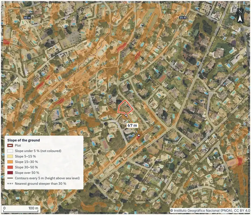
If you would like the plot's geology, slope and other ground risks in one document before calling a surveyor, you can order the report with the cadastral reference.
Common questions
How do I know whether my plot is on gypsum?
Locate it on the IGME's MAGNA 50 sheet and read the legend for the unit it falls in. If it shows gypsum, or river deposits over gypsum, raise it with your surveyor. The map shows what outcrops; only a ground survey confirms what lies beneath.
Is a geotechnical survey compulsory for a house?
For a new home built to a project, yes: the CTE requires geotechnical information as an annex to the project report, and DB SE-C sets a general minimum of three survey points. Buying an existing house carries no such duty, but you may commission one yourself.
Will the Consorcio pay if a sinkhole opens under my house?
RD 300/2004 excludes settlement of land and similar phenomena, unless clearly caused by the rain that produced an extraordinary flood in the area and happening at the same time (art. 6.g). Otherwise it depends on what your policy says.
Does the sinkhole risk show on the nota simple?
The sources checked provide for no land registry entry for karst risk in the nota simple (land registry extract). Look for it on the IGME maps, the regional map where one exists and the town plan.
What does T-3 ground mean?
It is the unfavourable ground group in DB SE-C. It includes, among others, karst ground in gypsum or limestone. Extra survey points must be added in the problem zones.
Keep reading
Check this on your own plot
Pin the plot on the map and confirm the cadastral reference: the report gathers the public data and official maps for it, each with its source and date. It does not replace the land registry extract, the notary or a tax adviser. €29 VAT included.